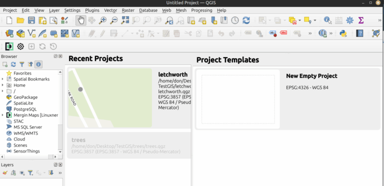
Recently, a friend asked me if I could help him map his walk around the area where he lives. I use a pedometer to track my steps and in the past I have used several different map walking apps on my phone and smartwatch. I told my friend that I would do some additional research and get back to him. Returning home later in the day and using AI I found about a half dozen mapping applications. QGIS caught my attention because it is open-source. I decided to give it a try and install it on my Linux computer. I decided to use the Flatpak installation as it was the easiest on Linux Mint.
$ flatpak install flathub org. qgis.qgis
You will be prompted for the version of QGIS you want to use, and the app should appear in your application launcher. QGIS has excellent documentation and can be installed on nearly any of the popular computing platforms, including macOS, Windows, Linux, FreeBSD, OpenBSD, and even as container images. Be sure to follow their excellent documentation.
Once I launched the application, I was presented with an incredibly complex toolset and wanted to dive in. QGIS allows users to create, edit, visualize, analyze, and publish geospatial data. QGIS supports various data formats, including vector, raster, and database formats, and provides tools for creating maps, performing spatial queries, and generating reports. I simply wanted to create trail maps and count steps for my friend and teach him to do the same.
I listened to a podcast which gave me a good overview of the project and some the capabilities of QGIS. I learned that QGIS is open source with a GPL v2 license. I learned that it was initially released in 2002. I’m using version 3.44 “Solothurn.” The podcast mentioned that QGIS is extended with plugins, of which there are currently over 1,300. Which ones would I need to map the trails at the retreat center that my friend lived at?
The first plugin I installed was Quick Map Services. This allowed me to download OpenStreetMap. Now I have some data, but how can I use this? More help from my AI App helped me to find MerginMaps. MerginMaps is a plugin that extends QGIS. They have an app for iOS and Android. I could use my mobile phone for data collection. MerginMaps is also open source. MerginMaps mobile is open source too! I needed to install the MerginMaps plugin in QGIS first. Go to ‘Plugins’ on the menu bar at the top and select ‘Manage and Install Plugins.’ Use the ‘Search’ window to search for ‘MerginMaps.’
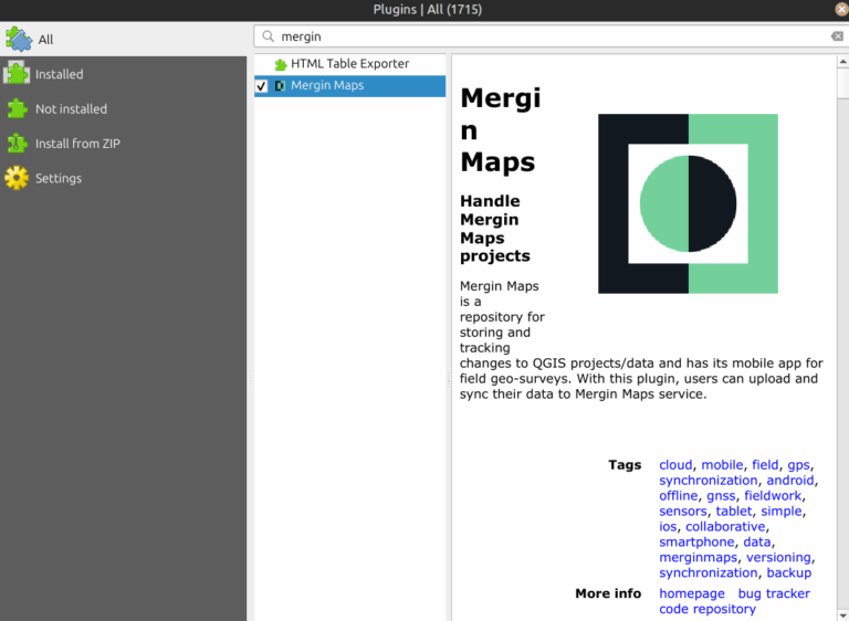
At the bottom of the window is a button to ‘Install Plugin’. Once the plugin is installed, you are ready to install MerginMaps with QGIS. I needed to install MerginMaps on my iPhone. The next step is to create a MerginMaps account. You will need an account to use the plugin.

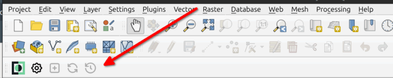
The next step is to sign in to your MerginMaps account in QGIS. When you installed the MerginMaps plugin in the QGIS software program, it altered your menu options slightly. The arrow is pointing to the Mergin Menu options. The second item is the one that looks like a gear, where you sign in to Mergin. That is the configure button.
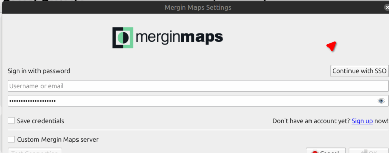
Upon clicking on that button, you will be prompted to sign in to MerginMaps.
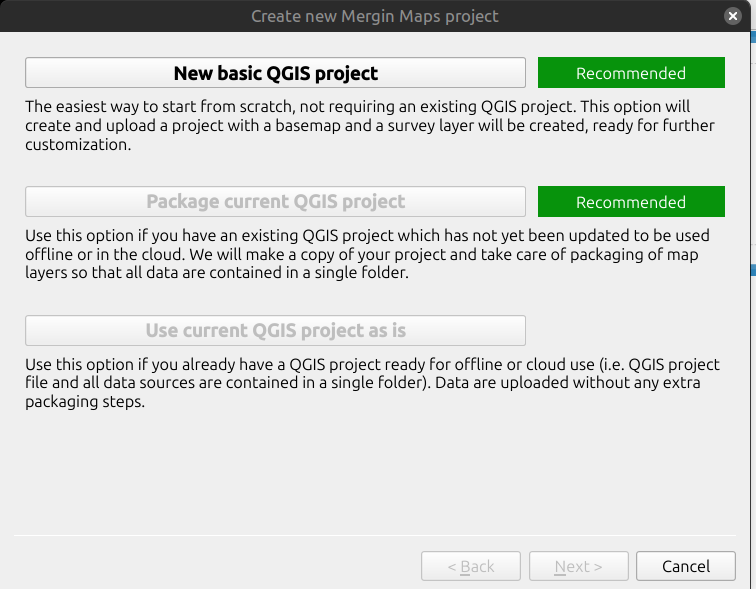
Once you have signed into MerginMaps, you can begin your first project. Next to the gear-like ‘Configure’ button is another button with a plus sign on it. Clicking on that brings up a ‘New basic QGIS project’ option.
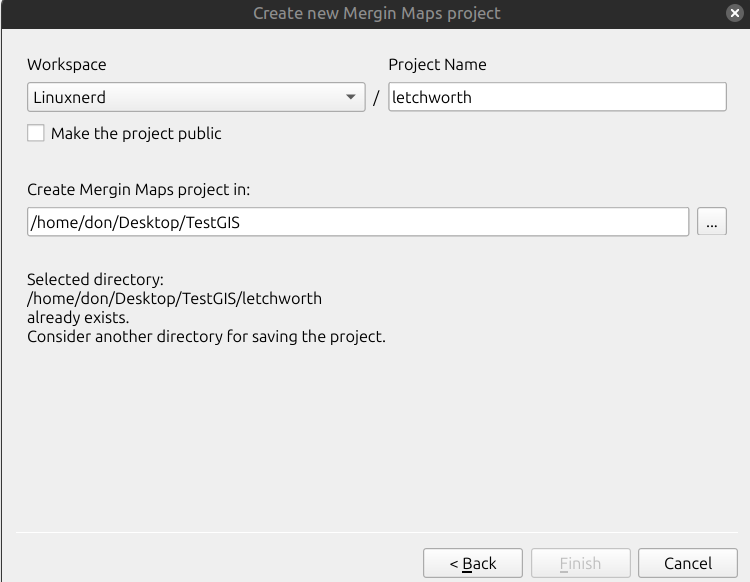
After the new project is created, you are invited to give it a name. Once named, the project is immediately uploaded to the MerginMaps server account and saved locally in a directory location of your choice.
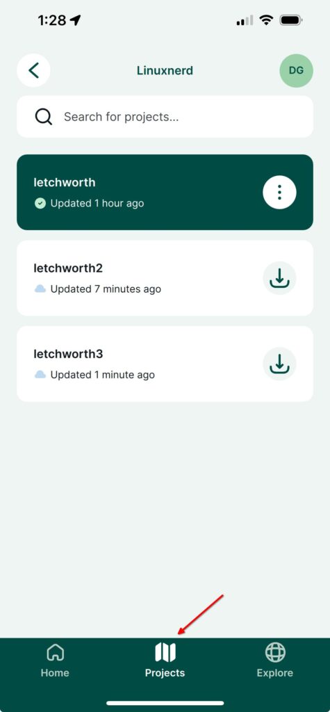
After the project is uploaded to the MerginMaps server, it is time to get out your iOS or Android device and sign in to the MerginMaps server to download the project onto your mobile device. Note that at the bottom of the application window, there is a ‘Projects’ button which, when pressed, provides a listing of the projects on your device.
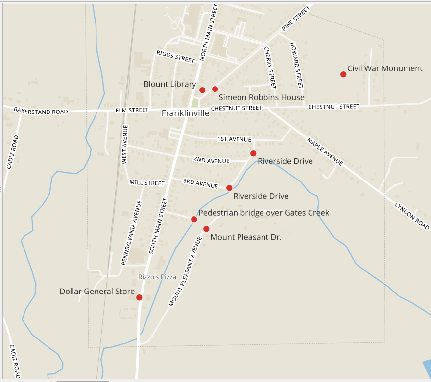
I decided to give the application a test run by mapping points during my daily walk around the village. I created a MerginMaps project in QGIS and uploaded it to the server. Then I downloaded the project onto my iPhone and set off around the town. Once the data points are collected on the device, they can be uploaded to the MerginMaps server and then downloaded to the QGIS software on your computer, and you can generate maps. Here is a map of my walk today in Franklinville, New York.
In conclusion, QGIS and MerginMaps offer a powerful combination for mapping. Together, they provide a robust solution for mapping trails, making it easier for my friend to learn how to do the same. The integration of QGIS with MerginMaps highlights the potential of open-source tools in facilitating geospatial data work, whether for individual use or team-based projects. This synergy between the two platforms is a valuable resource for anyone interested in mapping and spatial analysis.